GeoInt
GeoInt & EO for Safe & Security
Earth Observation
refs
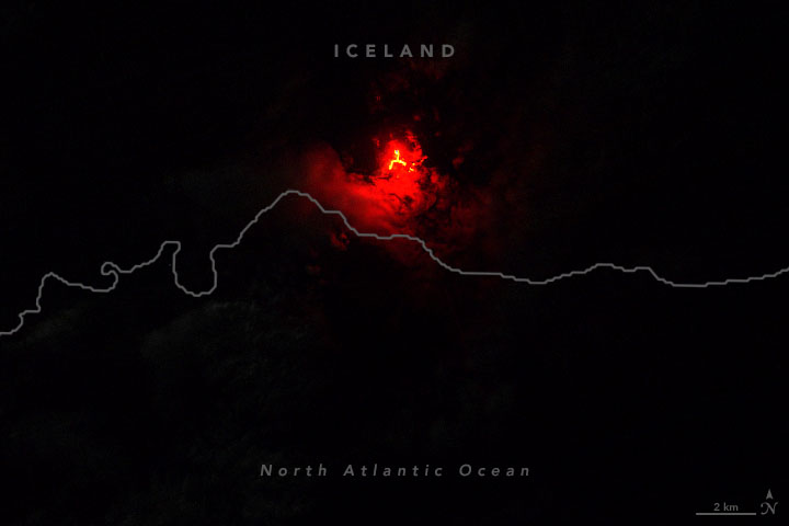
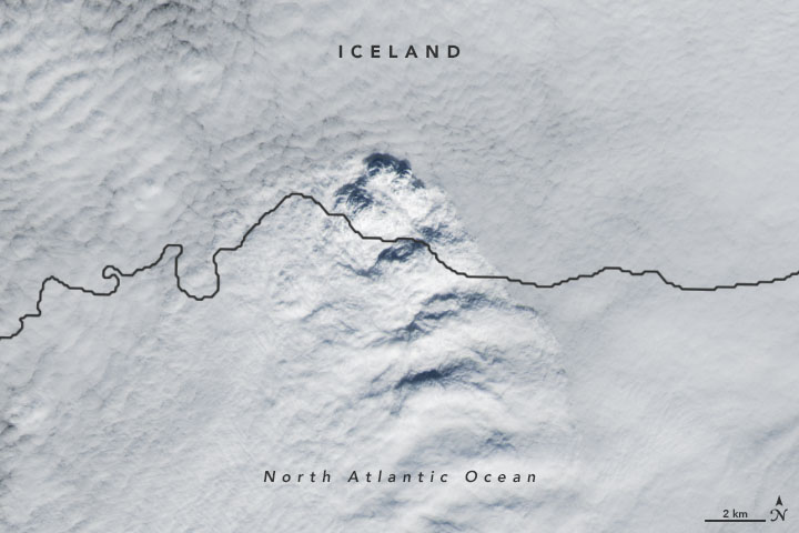
- evidence of recent changes in the deformation data (cGNSS) around Askja. https://en.vedur.is/
- NASA Earth Observatory images by Joshua Stevens, using Landsat data from the U.S. Geological Survey. Story by Kathryn Hansen. https://earthobservatory.nasa.gov/images/148282/a-curious-case-of-clouds-in-iceland
Passengers Personnel
Tools on incidents & movements, mapping, charting, imagery analysis, and intelligence for Safe & Security
- [PNR-yaml] Intell by ICAO, WTO, IATA standards as used with US-EU PNR Agreements & US CFR § 122.49d
- Demo Maps to Country HR intel: https://infchg.github.io/geo-map3.svg
- ACLED & RedCross Miggration Maps and Info

Added PNR-yaml from 2020 proposals
US-EU PNR Agreements 2011, and EU & US CFR § 122.49d regulations
Build from previous 2018 measure-pub
Linux Bash Python Measurement scripts
Node Checks Tools
the tools to check nodes and The Measurement Cloud system can run also from this notebook in bash shell NodeCheck.ipynb
added Latex formulas into the jpynb see
Jupyter+py: ![]() Jupyter+:
Jupyter+: ![]()
Jupyter+R: ![]()
Jupyter+tree: ![]() RStudio:
RStudio: ![]()
RShiny: ![]()
recommended location and install
sudo mkdir -p /etc/measure
  sudo chmod 777 /etc/measure
  cd !$
git clone https://github.com/infchg/measure-pub
default configs as usual:
your configuration file:
git config --global --edit
After doing this, you may fix the identity used for this commit with:
git commit --amend --reset-author